Land For Sale | Serenity Creek - Laurel, Kentucky - 12.12 Acres, Tract 5
Map Disclaimer:
Parcel boundaries, pins, and tract locations shown on this map are approximate and for visual reference only. Boundaries are generated from coordinate data and may not reflect the exact shape of roads, streams, or other natural features that the legal survey follows. This map is not survey-grade and should not be used for legal, engineering, or surveying purposes.
View Full Disclaimer

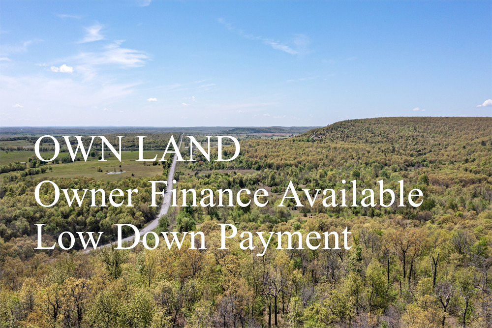


FSBO 12.12 Acres in Laurel, Kentucky
Serenity Creek Tract 5
Description
Tract 5 is a great opportunity to own a beautiful piece of Kentucky. This tract is strategically located for easy access within Serenity Creek. Being a short drive from town, yet set among several larger farms in the area, this property would be perfect for that person looking to retire, wanting a weekend getaway location or even a small hunting tract! Plenty of spots for a cabin, RV, deer stand, feeders, etc…Buy now and build later!
Local Attractions
- OneMain Financial, 10.7 miles, OneMain Financial, located in 14949 North US Highway 25 Ste 1, Corbin
- Advance Auto Parts, 13.3 miles, Chain stocking a wide variety of automotive partsaccessories such as batteriesoil filters.
- Advance Auto Parts, 19.8 miles, Chain stocking a wide variety of automotive partsaccessories such as batteriesoil filters.
- WKDP-FM Corbin, 19.9 miles, WKDP-FM Corbin, located in Gray
- Country InnSuites by Radisson, London, KY, 11.3 miles, Informal hotel featuring an indoor pool, a gyma complimentary hot breakfast buffet.
- Holiday Inn ExpressSuites London, an IHG Hotel, 11.3 miles, Straightforward lodging with an indoor poolfitness center, plus free breakfastWiFi.
Questions? CAll 469-361-8487
Tract Details
- Questions? Call: 469-361-8487
- Status: FOR SALE
- Price: $77,694.00
- Parcel: Tract 5
- Acres: 12.12
- Latitude: 37.241516
- Longitude: -83.974075
- Covenants: View
- To Visit, The following are Important..
- Map To Primary Access Path:View View
- Survey: View
- Tract GPS Borders:
37.244308,-83.972006
37.243559,-83.972849
37.244832,-83.976573
37.245096,-83.976519
37.245326,-83.976382
37.24595,-83.975977
37.246009,-83.975914 - All Tract Coordinates: View
- Use Notes:Grey
- Tract Layout (T1):

- Code: SRC-T5
- SKU: kentucky-laurel-serenitycreek-T5
Code:SRC-T5
SKU: kentucky-laurel-serenitycreek-T5
Price: $77,694.00
Parcel: Tract 5
Acres: 12.12
Latitude: 37.241516
Longitude: -83.974075
To Visit, Primary Access Route:
https://www.google.com/maps/place/37.24152,-83.97408
Survey:
https://d31w3hofg2vu6m.cloudfront.net/uploads/2023/08/serenity-creek-survey.pdf
Tract GPS Borders:
37.244308,-83.972006
37.243559,-83.972849
37.244832,-83.976573
37.245096,-83.976519
37.245326,-83.976382
37.24595,-83.975977
37.246009,-83.975914
Direct Links to Pins:
https://www.google.com/maps/place/37.244308,-83.972006
https://www.google.com/maps/place/37.243559,-83.972849
https://www.google.com/maps/place/37.244832,-83.976573
https://www.google.com/maps/place/37.245096,-83.976519
https://www.google.com/maps/place/37.245326,-83.976382
https://www.google.com/maps/place/37.24595,-83.975977
https://www.google.com/maps/place/37.246009,-83.975914
Tract Layout Image:
https://LandAndCreek.com/Uploads/Images/Property/kentucky/laurel/serenitycreek/T5/T1.jpg?v=SRC-T5
Covenants:
https://d31w3hofg2vu6m.cloudfront.net/uploads/2023/08/serenity-creek-covenants.pdf