Land For Sale | Buck Run Ridge - Wayne, Kentucky - 11.05 Acres, Tract 26
Map Disclaimer:
Parcel boundaries, pins, and tract locations shown on this map are approximate and for visual reference only. Boundaries are generated from coordinate data and may not reflect the exact shape of roads, streams, or other natural features that the legal survey follows. This map is not survey-grade and should not be used for legal, engineering, or surveying purposes.
View Full Disclaimer

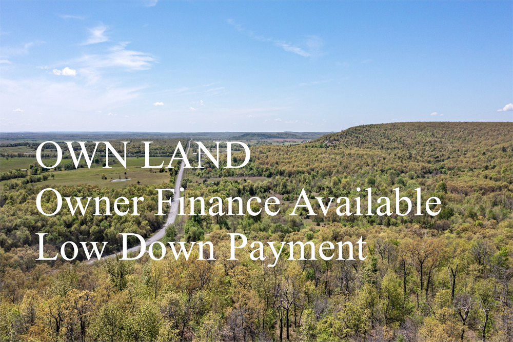


FSBO 11.05 Acres in Wayne, Kentucky
Buck Run Ridge Tract 26
Description
Tract 26 has great access along the provided dirt road. It is very wooded with tall, beautiful trees throughout. Many deer, turkey and other wildlife have been spotted in this area making this a great hunting tract! Being a short drive from town, yet set among several larger farms in the area, this property would be perfect for that person looking to retire, wanting a weekend getaway location or a great camping parcel! Plenty of spots for a cabin, RV, deer stand, feeders, etc…Buy now and build later!
Local Attractions
- Airgas Store, 18.2 miles, Warehouse selling weldingrelated safety equipment to hobbyistsprofessionals.
- Comfort Inn, 18.8 miles, Straightforward rooms with free hot breakfast buffetWiFi in a casual hotel with an indoor pool.
- Redbox, 21.2 miles, Kiosk chain renting movies, including new releases (many are located inside stores).
- Hampton Inn Somerset, 18.9 miles, Casual hotel with free parking, hot breakfastWiFi, plus an exercise rooman outdoor pool.
- Big South Fork National River and Recreation Area, 16.5 miles, Expansive park featuring gorgessandstone bluffs, Big South Fork National Rivercampgrounds.
- Whittle Cemetery, 22.0 miles, Whittle Cemetery is a historic burial ground
Questions? CAll 469-361-8487
Tract Details
- Questions? Call: 469-361-8487
- Status: FOR SALE
- Price: $66,990.00
- Parcel: Tract 26
- Acres: 11.05
- Latitude: 36.770027
- Longitude: -84.71155
- Covenants: View
- To Visit, The following are Important..
- Map To Primary Access Path:View View
- Survey: View
- Tract GPS Borders:
36.75885,-84.7153
36.75883,-84.71534
36.76021,-84.71006
36.7611,-84.71055
36.75911,-84.71551
36.7593,-84.71549
36.75954,-84.71555 - All Tract Coordinates: View
- Use Notes:Grey
- Tract Layout (T1):

- Code: BRR-T26
- SKU: kentucky-wayne-buckrunridge-T26
Code:BRR-T26
SKU: kentucky-wayne-buckrunridge-T26
Price: $66,990.00
Parcel: Tract 26
Acres: 11.05
Latitude: 36.770027
Longitude: -84.71155
To Visit, Primary Access Route:
https://www.google.com/maps/place/36.77003,-84.71155
Survey:
https://d31w3hofg2vu6m.cloudfront.net/uploads/2023/08/buck-run-ridge-survey.pdf
Tract GPS Borders:
36.75885,-84.7153
36.75883,-84.71534
36.76021,-84.71006
36.7611,-84.71055
36.75911,-84.71551
36.7593,-84.71549
36.75954,-84.71555
Direct Links to Pins:
https://www.google.com/maps/place/36.75885,-84.7153
https://www.google.com/maps/place/36.75883,-84.71534
https://www.google.com/maps/place/36.76021,-84.71006
https://www.google.com/maps/place/36.7611,-84.71055
https://www.google.com/maps/place/36.75911,-84.71551
https://www.google.com/maps/place/36.7593,-84.71549
https://www.google.com/maps/place/36.75954,-84.71555
Tract Layout Image:
https://LandAndCreek.com/Uploads/Images/Property/kentucky/wayne/buckrunridge/T26/T1.jpg?v=BRR-T26
Covenants:
https://d31w3hofg2vu6m.cloudfront.net/uploads/2023/08/buck-run-ridge-covenants.pdf