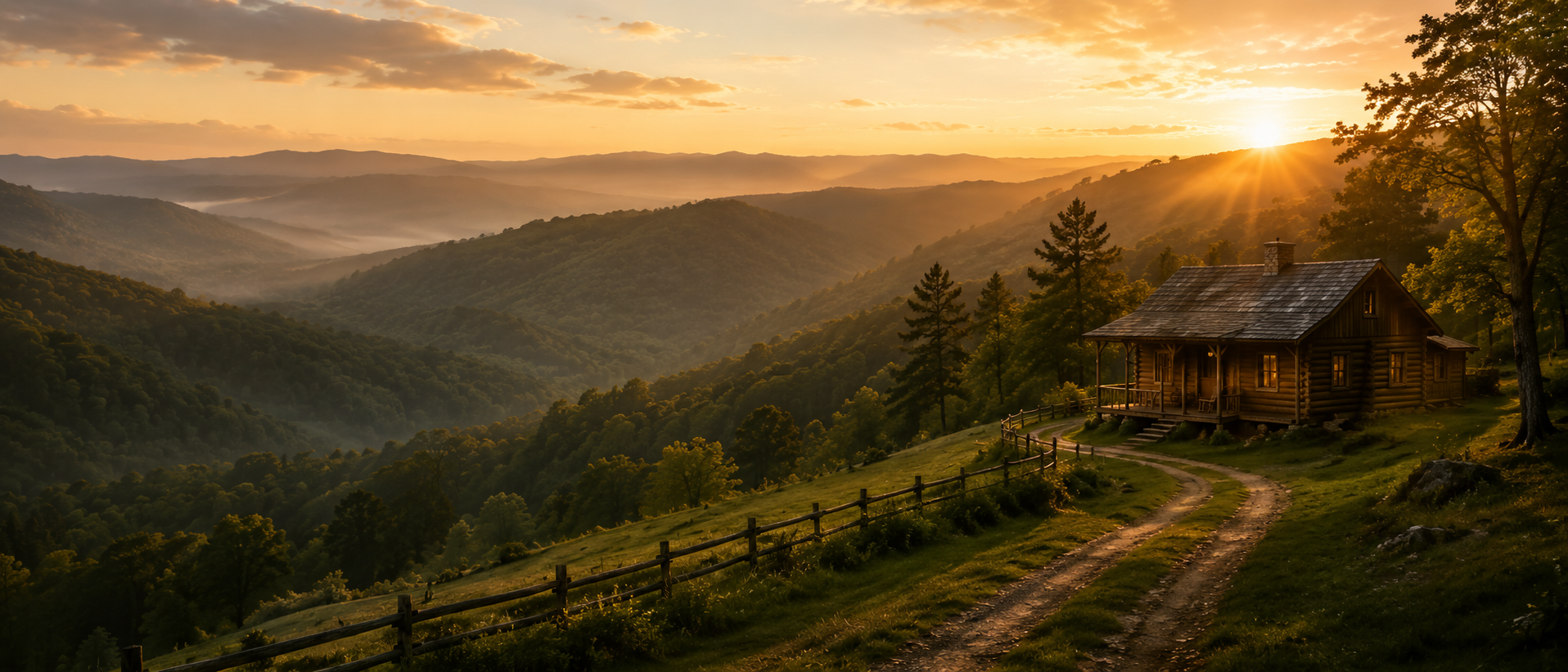
Whiskey Ridge Tract 97
Land for Sale in Henderson County, Tennessee
Currently available with 5.78 acres.
Current pricing is available by phone.
Contact Land & Creek at: 469-361-8487
View Other Tracts Map to Whiskey RidgeSKU: tennessee-henderson-whiskeyridge-T97 | Slug: whiskey-ridge-T97
Tract Summary
Whiskey Ridge Tract 97
State: Tennessee
County: Henderson
GPS: 35.56577, -88.47832
Acres: 5.78
Price: $-
Contact Land & Creek
469-361-8487Whiskey Ridge Tract 97
Review the available survey, coordinate file, and covenants for this specific tract before visiting or purchasing. Map pins and parcel lines are approximate and should be verified against the available documents.
Whiskey Ridge Tract 97
Whiskey Ridge Tract 97
Nearby / Local Notes
- La Quinta InnSuites by Wyndham Jackson, 20.9 miles, Casual lodging with an outdoor pool, plus free continental breakfast, parkingWiFi.
- Holiday Inn ExpressSuites Jackson Northeast, an IHG Hotel, 18.6 miles, Straightforward hotel offering free hot breakfast, WiFiparking, plus an outdoor pool.
- ODell Dennis, 19.2 miles, ODell Dennis, located in Jackson
- Courtyard Jackson, 20.1 miles, Modern hotel with an indoor poolan American restaurant, plus free WiFiparking.
- DoubleTree by Hilton Hotel Jackson, 21.8 miles, Modern hotel with free WiFi, an indoor/outdoor poolcontemporary Southern restaurant.
- Hampton InnSuites Jackson, 20.0 miles, Classic hotel with an outdoor poola fitness center, plus free breakfastWi-Fi.
Additional Property Information
Plat / Tract Layout

Map to Whiskey Ridge Tract 97
Map Disclaimer:
Parcel boundaries, pins, and tract locations shown on this map are approximate and for visual reference only.
Boundaries are generated from coordinate data and may not reflect the exact shape of roads, streams, or other
natural features that the legal survey follows. This map is not survey-grade and should not be used for legal,
engineering, or surveying purposes.
View Full Disclaimer
Photos of Whiskey Ridge Tract 97


Questions About Whiskey Ridge Tract 97
Quick answers for location, acreage, pricing, documents, owner financing, access, and how to view the other tracts at Whiskey Ridge.
Code:WSR-T97
SKU: tennessee-henderson-whiskeyridge-T97
Price: $-
Parcel: Tract 97
Acres: 5.78
Latitude: 35.565773
Longitude: -88.478325
To Visit, Primary Access Route:
https://www.google.com/maps/place/35.56577,-88.47832
Survey:
https://d31w3hofg2vu6m.cloudfront.net/uploads/2023/08/whiskey-ridge-survey.pdf
Tract GPS Borders:
35.58172,-88.47903
35.58182,-88.47999
35.58181,-88.48008
35.58189,-88.48034
35.58191,-88.4807
35.582,-88.48085
35.58337,-88.48006
35.58341,-88.479
Direct Links to Pins:
https://www.google.com/maps/place/35.58172,-88.47903
https://www.google.com/maps/place/35.58182,-88.47999
https://www.google.com/maps/place/35.58181,-88.48008
https://www.google.com/maps/place/35.58189,-88.48034
https://www.google.com/maps/place/35.58191,-88.4807
https://www.google.com/maps/place/35.582,-88.48085
https://www.google.com/maps/place/35.58337,-88.48006
https://www.google.com/maps/place/35.58341,-88.479
Tract Layout Image:
https://landandcreek.com/Uploads/Images/Property/tennessee/henderson/whiskeyridge/T97/T1.jpg?v=WSR-T97
Covenants: